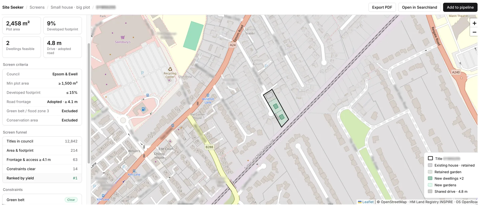
A tool that finds underdeveloped plots across a whole region by layering land titles, planning boundaries and building footprints - including pairs of plots that only become viable when merged.
The problem
Finding a development site normally means cross-referencing land ownership, planning boundaries and what's actually been built, by hand, one postcode at a time. It's slow, it doesn't scale past a borough, and it structurally misses the most interesting opportunities: plots that are only viable when combined with a neighbour, because nobody checks pairs by hand.
What I built
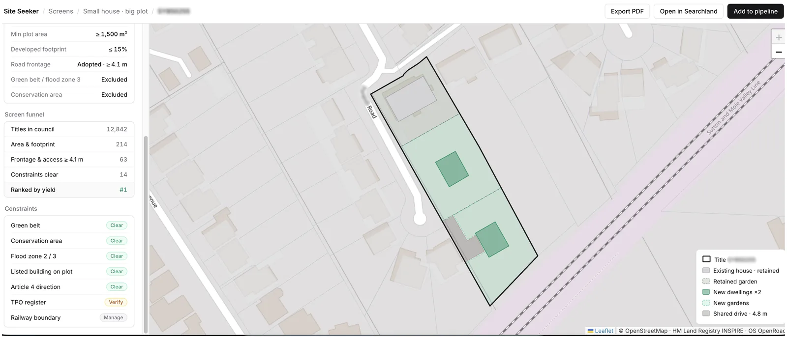
Site Seeker layers three datasets: Land Registry title polygons (INSPIRE), planning boundaries, and OpenStreetMap building footprints. A custom geometry solver then runs over every plot in a set region. For each title it computes how much of the permissible envelope is actually built, and flags plots where the gap is large.
The solver then finds the optimal position for a new house and quickly stress-tests it: road access, UK size and separation standards, and the other criteria that largely determine a site's viability.
It also tests adjacent plots as pairs: two parcels that are individually too small or awkwardly shaped often clear the viability threshold once merged. Results are ranked and rendered on a map, so the practice reviews a shortlist.
The result
Region-wide sweeps replace postcode-by-postcode searching, and the shortlists include merged-pair candidates a manual search can't surface. The tool is in active use in the practice's site-acquisition work; current development is on speed: caching results so a sweep returns near-instantly instead of after a long processing run.